


novopacko.cz > Home > MAPA
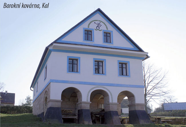
On a plateau 3 km SE of Pecka lies the village of Kal, which takes its name either from the bogs and sludge which complicated the passage around the Bystry and Kalsky brooks, or from the poles which used to designate the bogs near the roads.
The oldest record on the village dates back to 1497. Until 1850 it belonged to Miletin, later it became a borough in the district of Horice. On 1st January 1975, its administration was merged with Pecka.
")
")


